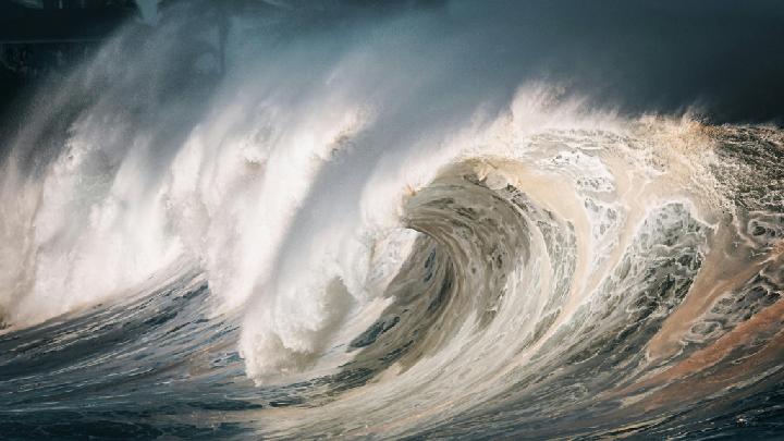

BMKG Issues High Wave Warning in Several Indonesian Waters Reporter Irsyan Hasyim November 12, 2025 | 11:03 am TEMPO.CO, Jakarta – The Indonesian Meteorology, Climatology, and Geophysics Agency (BMKG) has issued an early warning of high waves that are likely to occur in several Indonesian waters on November 11 to 14, 2025.BMKG forecaster Furqon Alfahmi said that the tropical cyclone Fung-Wong (17.4 North Latitude, 119.2 East Longitude) in the West Philippine Sea has triggered an increase in wind speed and wave height. Meanwhile, the wind patterns in the northern part of Indonesia generally move from southwest to northwest with wind speeds ranging from 4-30 knots, while in the southern part, they generally move from southeast to southwest with wind speeds ranging from 4-25 knots. “The highest wind speed was observed in the Sulawesi Sea and the western Indian Ocean of the Mentawai Islands,” he said in a written statement on Tuesday, November 11, 2025.This condition has caused an increase in waves ranging from 1.25 – 2.5 meters likely to occur in the northern part of the Malacca Strait, the western Indian Ocean off Aceh, the western Indian Ocean off Nias Islands, the western Indian Ocean off the Mentawai Islands, the western Indian Ocean off Bengkulu, the western Indian Ocean off Lampung, the southern Indian Ocean off Banten, the southern Indian Ocean off West Java, the southern Indian Ocean off Yogyakarta, the southern Indian Ocean off Central Java, the southern Indian Ocean off East Java, and the southern Indian Ocean off Bali.Similar waves are likely to occur in the southern Indian Ocean off West Nusa Tenggara, the southern Indian Ocean off East Nusa Tenggara, the northern part of the Karimata Strait, the southern part of the Karimata Strait, the western part of the Java Sea, the middle part of the Java Sea, the eastern part of the Java Sea, the southern part of the Makassar Strait, the middle part of the Makassar Strait, the northern part of the Makassar Strait, the western part of the Sulawesi Sea, the middle part of the Sulawesi Sea, the eastern part of the Sulawesi Sea, the Maluku Sea, the northern Pacific Ocean off Maluku, the northern Pacific Ocean off Southwest Papua, the northern Pacific Ocean off West Papua, the western part of the Arafura Sea, and the middle part of the Arafura Sea.Furthermore, higher waves in the range of 2.5-4.0 meters are likely to occur in the northern Natuna Sea, northern Pacific Ocean off Papua. “The potential for high waves in these regions may pose risks to maritime safety,” he said.Furqon said that the BMKG urges the public to always be vigilant, especially for fishermen who use transportation modes such as fishing boats to be cautious of wind speeds exceeding 15 knots and wave heights above 1.25 meters, while barge ships are advised to avoid wind speeds exceeding 16 knots and wave heights above 1.5 meters.For ferries, they should be wary of wind speeds exceeding 21 knots and wave heights above 2.5 meters, while large vessels such as cargo ships and cruise ships are advised to avoid wind speeds exceeding 27 knots and wave heights above 4.0 meters.”We urge residents living and working on the coast in areas with potential for high waves to always remain vigilant,” said Furqon.Editor’s Choice: BMKG: Beware of 6-Meter High Waves in South BantenClick here to get the latest news updates from Tempo on Google News BMKG Issues High Wave Warning in Several Indonesian Waters Reporter Irsyan Hasyim November 12, 2025 | 11:03 am TEMPO.CO, Jakarta – The Indonesian Meteorology, Climatology, and Geophysics Agency (BMKG) has issued an early warning of high waves that are likely to occur in several Indonesian waters on November 11 to 14, 2025.BMKG forecaster Furqon Alfahmi said that the tropical cyclone Fung-Wong (17.4 North Latitude, 119.2 East Longitude) in the West Philippine Sea has triggered an increase in wind speed and wave height. Meanwhile, the wind patterns in the northern part of Indonesia generally move from southwest to northwest with wind speeds ranging from 4-30 knots, while in the southern part, they generally move from southeast to southwest with wind speeds ranging from 4-25 knots. “The highest wind speed was observed in the Sulawesi Sea and the western Indian Ocean of the Mentawai Islands,” he said in a written statement on Tuesday, November 11, 2025.This condition has caused an increase in waves ranging from 1.25 – 2.5 meters likely to occur in the northern part of the Malacca Strait, the western Indian Ocean off Aceh, the western Indian Ocean off Nias Islands, the western Indian Ocean off the Mentawai Islands, the western Indian Ocean off Bengkulu, the western Indian Ocean off Lampung, the southern Indian Ocean off Banten, the southern Indian Ocean off West Java, the southern Indian Ocean off Yogyakarta, the southern Indian Ocean off Central Java, the southern Indian Ocean off East Java, and the southern Indian Ocean off Bali.Similar waves are likely to occur in the southern Indian Ocean off West Nusa Tenggara, the southern Indian Ocean off East Nusa Tenggara, the northern part of the Karimata Strait, the southern part of the Karimata Strait, the western part of the Java Sea, the middle part of the Java Sea, the eastern part of the Java Sea, the southern part of the Makassar Strait, the middle part of the Makassar Strait, the northern part of the Makassar Strait, the western part of the Sulawesi Sea, the middle part of the Sulawesi Sea, the eastern part of the Sulawesi Sea, the Maluku Sea, the northern Pacific Ocean off Maluku, the northern Pacific Ocean off Southwest Papua, the northern Pacific Ocean off West Papua, the western part of the Arafura Sea, and the middle part of the Arafura Sea.Furthermore, higher waves in the range of 2.5-4.0 meters are likely to occur in the northern Natuna Sea, northern Pacific Ocean off Papua. “The potential for high waves in these regions may pose risks to maritime safety,” he said.Furqon said that the BMKG urges the public to always be vigilant, especially for fishermen who use transportation modes such as fishing boats to be cautious of wind speeds exceeding 15 knots and wave heights above 1.25 meters, while barge ships are advised to avoid wind speeds exceeding 16 knots and wave heights above 1.5 meters.For ferries, they should be wary of wind speeds exceeding 21 knots and wave heights above 2.5 meters, while large vessels such as cargo ships and cruise ships are advised to avoid wind speeds exceeding 27 knots and wave heights above 4.0 meters.”We urge residents living and working on the coast in areas with potential for high waves to always remain vigilant,” said Furqon.Editor’s Choice: BMKG: Beware of 6-Meter High Waves in South BantenClick here to get the latest news updates from Tempo on Google News
Source: en.tempo.co